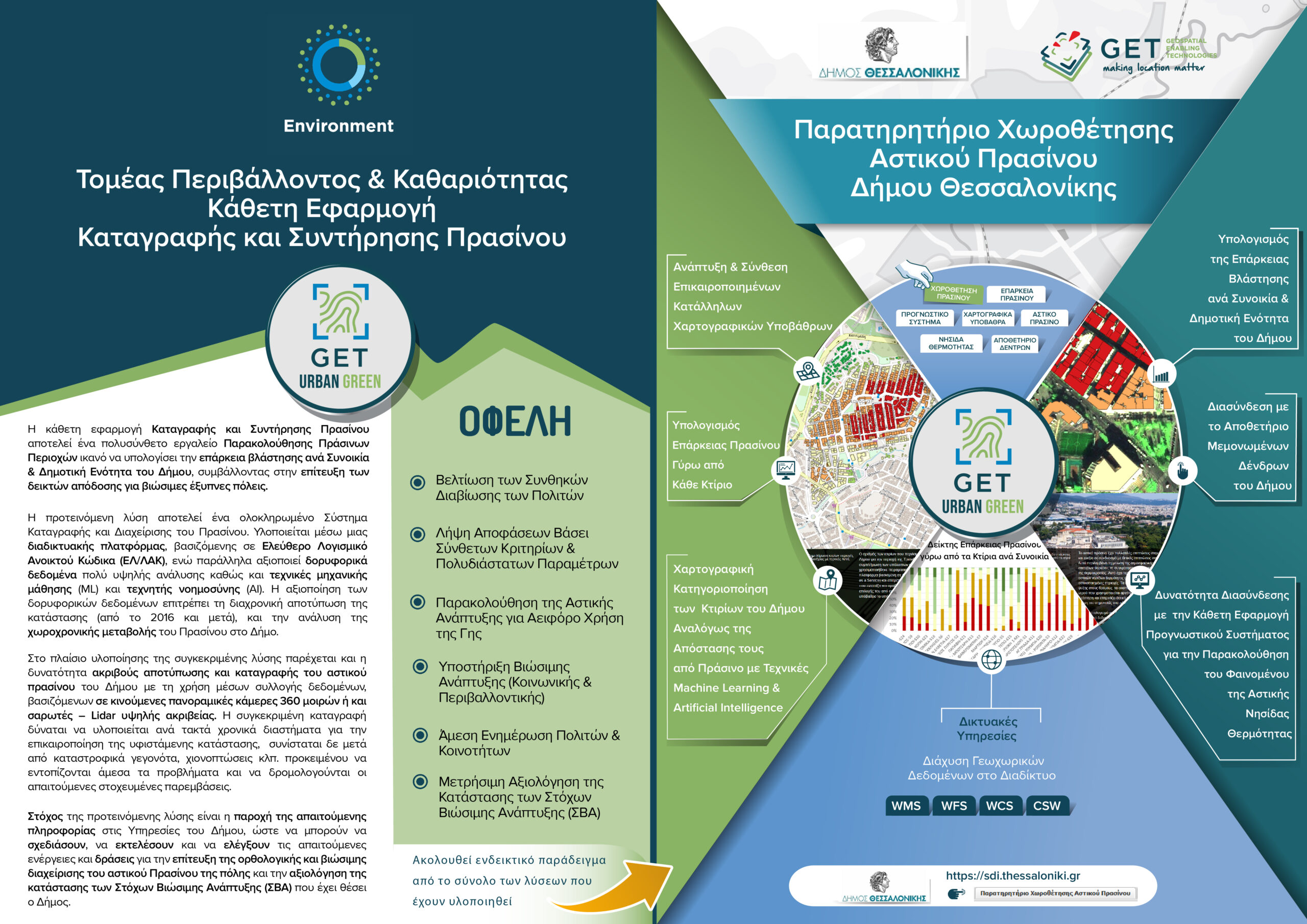
Observatory οf Urban Green Siting for The Municipality οf Thessaloniki
GET, within the scope of the satellite imagery service of the COPERNICUS system that provides to the Municipality of Thessaloniki and with a view to the maximum reuse of the project results by the public, institutions and professionals, developed the application “Observatory οf Urban Green Siting ” of the Municipality.
This web story is part of the Geospatial Information Portal of the Municipality of Thessaloniki and presents aggregate data regarding the distribution of urban green within the boundaries of the Municipality, as well as the categorization of the Municipality buildings based on their distance from green clusters, as shown from the time change of the NDVI index of high resolution satellite data Sentinel-2 for the year 2019.
The development of this application included:
- The development and composition of appropriate cartographic backgrounds
- The mapping of the remaining buildings of the Municipality, for the area of Triandria with techniques of machine learning (machine learning) and artificial intelligence (artificial intelligence)
- The calculation of the adequacy of vegetation per district and municipal unit of the Municipality, against the background of the vector data set of the buildings
- The export of statistics on the adequacy of vegetation by district and municipal unit of the Municipality
- The interconnection of the Observatory with the repository of individual trees of the Municipality and the dynamic data from the forecast system of the urban thermal island of the LifeAsti project
- The addition of appropriate explanatory texts
The percentages of the adequacy of the vegetation and the number of buildings per category of adequacy, calculated for each district and Municipal unit of the Municipality are available posted on the page of the Observatory.
In addition, a mosaic of very recent very high resolution Pleiades satellite data (0.5 m PAN, 2m MS, 2019-2020) is displayed. For all satellite images, the user, depending on their needs, can choose from a variety of multispectral compositions including TrueColor L2A, NDVI & Green City, False Color IR for Sentinel-2 and NDVI PAN, True Color PAN, False Color, NDVI.
Finally, the observatory also serves the needs of a repository of other environmental data related to the green of the Municipality. For this purpose, it displays the individual positions of the trees while at the same time it displays dynamic data from the forecasting system of the urban thermal island of the LifeAsti project.

TECHNOLOGY
- GET SDI Portal
- PostgreSQL
- Geoserver
- GETOpenData
PROFILE
Name: Municipality of Thessaloniki
Municipality of Thessaloniki is the second largest Municipality of Greece in terms of population. Municipality of Thessaloniki provides a wide range of eServices to the public following technological evolution and improving citizens life.
Website http://www.thessaloniki.gr/


