Application for Monitoring Environmental Indicators using Remote Sensing – Environmental Observatory for the Municipality of Agrinio
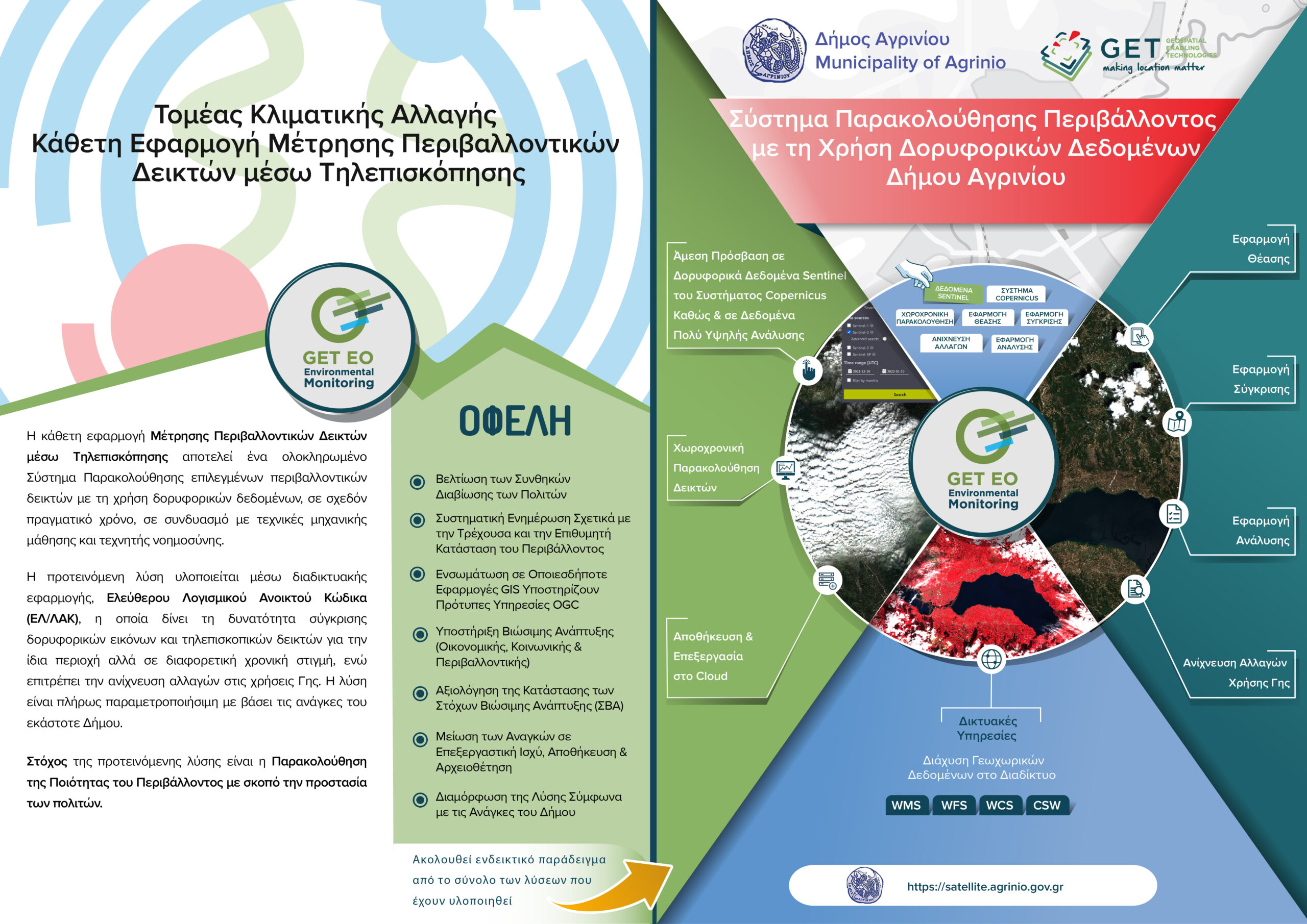
GET in the scope of the innovative project of the Environmental Observatory for the Municipality of Agrinio, developed the specific subsystem of the Environmental Observatory which refers to the monitoring of the environmental indicators using satellite data.
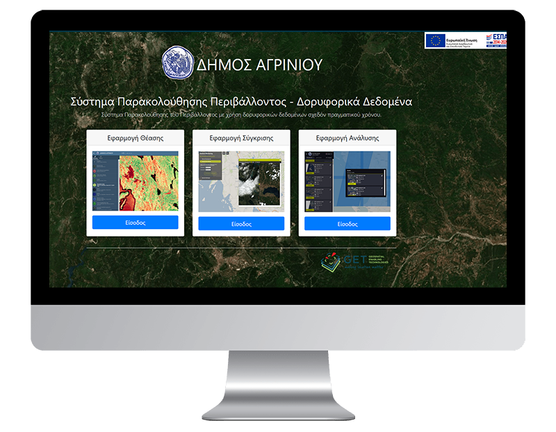
The near-real-time satellite monitoring system is an online application that provides instant and easy access to the open Sentinel satellite data of the European Copernicus System.
To meet the needs of environmental monitoring, mainly Sentinel 2 data are used. The data of Sentinel 2 are optical multispectral data of high quality and resolution (10 – 20m depending on the spectral area) that enable the systematic and operational monitoring of the environment. They are available in almost real time and are immediately available through the use of online services but also through a viewing and downloading application.
The users of the application have the possibility to choose the simple visualization of the satellite data and indicators resulting from them in different ways, in order to draw useful conclusions for the area of interest, be it the urban fabric, agricultural crops or nature protection areas, while in addition services based on automated techniques are provided.
The services of real time access to satellite data and indicators are addressed to all the services of the Municipality (e.g. Civil Protection, Environment, Technical Service) but also to the citizen, environmental organizations and non-governmental organizations and provide:
- The ability to visualize satellite images in the form of multispectral geo-referenced image (RGB) such as natural color, near-infrared, etc. or a single channel (single band or indicator). Indicators are calculated from one or more spectral regions according to the international literature. Indicatively, the indices NDVI, NDWI, LAI, EVI etc. are mentioned. The users can choose the time interval, as well as the parameters related to the cloud (maximum allowed percentage of cloud).
- The ability to compare satellite images and indicators for the same area but at different times. In this way one can easily detect through observation and processing the changes in land uses related to man-made interventions or natural disasters such as floods or fires.
- The ability to compare satellite images for the same area and time but with a choice of different visualization. For example, the comparison of the NDVI vegetation index with the NDWI soil moisture index can be chosen.
- The ability to monitor key environmental indicators (e.g. chlorophyll-α and temperature) in order to accurately assess the environmental status of lake waters (Trichonida, Lysimacheia, Ozeros, Kastraki, Kremasta, Stratos) in the context of actions for the protection and management of water resources and of their tourist development. These indicators are derived from Sentinel data with special analysis and are freely available in the Copernicus Earth observation data repository.
- Real-time access for the professional farmer, agronomist, agricultural cooperative, to indicators related to the modeling of soil moisture NDWI (Normalized Difference Water Index), NDMI (Normalized Difference Moisture Index), cultivation development through the normalized Difference Vegetation Index) and other related indicators. In this way, tools are provided for the utilization of the rich plain, as well as the strengthening of the primary production sector, which are important advantages of the Municipality. The utilization of these services will contribute substantially to the development of economic activity, and to the improvement of the competitiveness of agricultural products.
- Automated land use change detection in specific sensitive areas utilizing machine learning and AI techniques. This service is addressed to the Services of the Municipality whose mission is the protection of the environment. It is a pioneering deterrent service since, at any time, it can systematically and with increased probability of success, identify areas where (illegal) land use change has taken place.
The implementation was based on the utilization of the Sentinel Hub subscription service, which provides direct access to the Sentinel data of the Copernicus system using WMS and WCS internet services, as well as the utilization of the Picterra subscription service, which allows the automated detection of land use changes using of the capabilities of the platform.
The Environmental Observatory of the Municipality of Agrinio is part of the “Digital Strategy of the Municipality of Agrinio 2019-2024” and the main “Priorities of the National Digital Strategy within the Regional Operational Programs of the NSRF 2014-2020”, and includes the creation of an environmental observatory Strengthening administrative capacity in environmental monitoring issues, while disseminating information to the public to enhance knowledge and participation in public life and the political process.

TECHNOLOGY
- PostgreSQL/PostGIS
- Geoserver
- GeoWebCache
- Geonetwork Opensource
- GET SDI PORTAL
- GETOpenData


