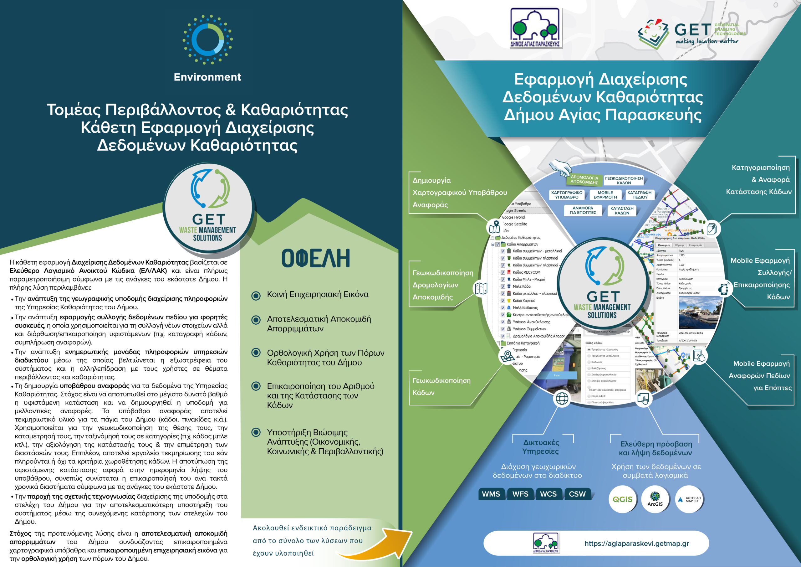
Application for Management of Cleaning Data for the Municipality of Agia Paraskevi
GET successfully completed another project in the field of Local Government and more specifically in the Municipality of Agia Paraskevi, which being our long-term customer, has acquired a complete geoinformation infrastructure based on open-source technology.
The infrastructure hosts a large number of geospatial data and serves the functions of the Municipality at the operational level. Given the positive response of internal users (executives of the Municipality), the proven time savings in the documentation of the existing urban planning, but also of external users (e.g., Building services, engineers who demonstrate the operation on site visits, citizens) the Municipality of Agia Paraskevi systematically invests in the expansion of the operational possibilities of the system.
In the scope of this project, given the maturity of the system and the transfer of know-how to the internal users of the system, the Cleaning Data Management application of the Municipality was developed, which is based on Free and Open-Source Software (FOSS).
The vertical application for the Management of the Cleaning Data is an important tool for monitoring the waste collection process. The implemented solution includes:
- The development of the spatial data infrastructure for the management of information of the Cleaning Services through the appropriate planning, scheduling, collection, organization and data management.
- The development of a field data collection application for mobile devices. The application is used for the collection of new, but also for the correction / updating of existing data (which were available after the completion of the project) and which related to the cleaning and waste management infrastructure of the Municipality (e.g. registration of bins, completion of reports).
- The development of a website for the dissemination of geoinformation to the public, through which the extroversion of the system and the ability to interact with users, on issues related to the environment and cleanliness.
- The creation of a reference background for the data of the Cleaning Services. The aim was to capture the current situation and to create the information database that will be the basis for future reports. The reference background is a documentary material for the road network and the fixed assets of the Municipality (such as bins, plates, columns, etc.). It is used for the geocoding of the position of the fixed assets (e.g. bins, plates, etc.), for their counting, for their classification into categories (e.g. plastic waste bin, small plastic waste bin, blue bin, paper bin, etc.), for the evaluation of their condition, for the measurement of the dimensions of the fixed assets (e.g. height bucket).
- The provision of the relevant know-how to the executives of the Municipality in order to ensure the valoriazation and sustainability of the application.
The aim of this application is the efficient waste collection of the Municipality by combining updated cartographic backgrounds and up to date operational picture for a wise use and management of the resources of the Municipality.

TECHNOLOGY
- PostgreSQL
- PostGIS
- Quantum GIS (QGIS)
- Geoserver
- GeoWebCache
- Geonetwork Opensource
- GET SDI Portal
- WordPress
- ODK
USEFULLY LINKS
PROFILE
Name: Municipality of Agia Paraskevi
Website: https://www.agiaparaskevi.gr/portal/
Agia Paraskevi is a municipality in the region of the Northern Sector of Athens, extending at the eastern end of the Athenian plain to the mountains of Hymettus. The area is estimated at 7,935 sq.km. (5.64 sq.m. inhabited) and its permanent population according to the 2011 census amounts to 59,704 inhabitants, with a density of 7,524 people per sq.m.
It is 7.5 to 11 kilometers from the center of the capital and administratively “belongs” to the territorial jurisdiction of the Attica Region and the Decentralized Administration of Attica. It is also part of the (informal) “complex” of the Northern Suburbs, which is a modern transportation hub and at the same time an area that has not ceased to become increasingly attractive to residents of the basin in the last 35 years.


