With more than 9,837 marine islands (islands, small rocky islands and deserted islands), the Greek islands account for 16% of the country’s total land area, ranking Greece among the top island nations in the world.
Greece has the highest percentage of island population and area, of all the European Union countries. The essential difference from the second (Italy), is that the Greek island area is scattered and consists of very small islands, which exacerbates the problem of insularity. The challenges it faces, both at political and environmental levels, are significant, which makes it important to protect and enhance it.
The aim of all relevant stakeholders should be to strengthen the islands’ local government. At the same time, it is necessary to find a sustainable development model with main pillars the sustainable and intelligent management of natural resources and infrastructure, the sustainable tourism and the functional interconnection of the primary with the secondary and tertiary sectors.
In this context, the Spatial Data Infrastructure (SDI) for the Island Area (DAFNI) was developed. The initiative for this portal was by the Aegean Energy & Environment Bureau in collaboration with the Dafni Sustainable Islands Network, which will eventually be the final beneficiary and administrator. The application was developed by GEOSPATIAL ENABLING TECHNOLOGIES.
The project was funded by the Green Fund under the measure “Innovative Actions with Citizens” under the thematic priority “Developing and implementing policies or actions for the utilization and sustainable management of natural resources” of the Program “Natural Environment & Innovative Environmental Actions 2018”.
The SDI is open for all users and access to its data is free.
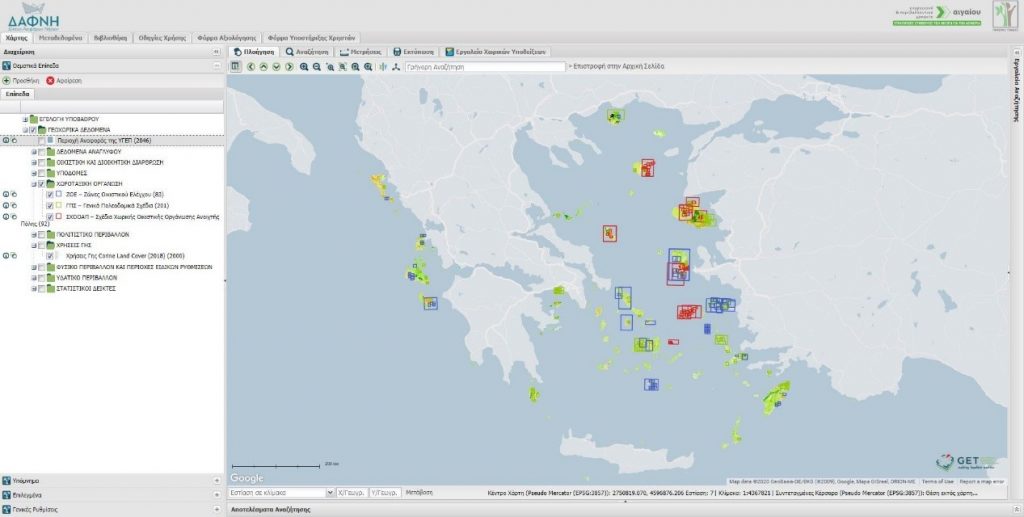
It includes several layers of geospatial information (infrastructures, natural resources, land use, spatial data organization plans) that are primarily related to the Environment and Local Development. Their collection and organization were performed in order to provide the highest possible reliability and up-to-date information.
It is a valuable tool for research (scholars, universities, citizen associations) and policy making. It is primarily targeted at local authorities as well as service providers in the wider public sector, offering the ability to extract mapped information on a wide range of topics. It is also aimed at individuals and professionals involved in the design or execution of projects, as well as prospective investors.
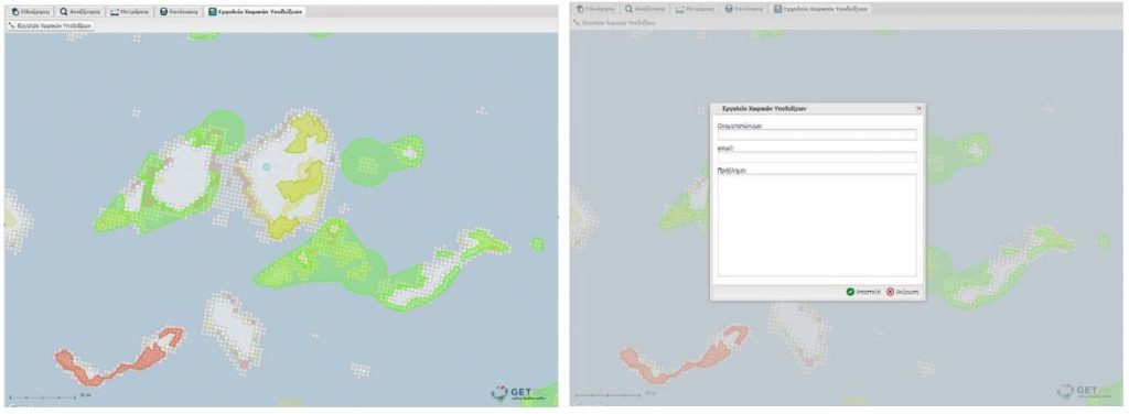
The key element of its innovation is the interactivity and the ability of users to intervene to correct errors or point out more appropriate approaches.
Technical characteristics
The development of the SDI was based on the software GET SDI Portal®, which is an integrated Open Source Mapping Platform developed by GEOSPATIAL ENABLING TECHNOLOGIES. It provides an integrated web platform based on ISO / OGC standards for the management of geospatial data from a variety of sources, making it the ideal solution for the development of web mapping (Web GIS) and spatially enabled web portals (Geoportals).
The technology used is based on open and free software (Openlayers, ExtJS, GeoExt and Proj4js) and works in combination with other open source software (Geoserver and Geonetwork).
Indicatively, some of the many features of the software are:
- visualization, viewing and analysis of geospatial data
- searching and query capabilities (spatial, attribute, complex)
- Metadata management
- downloading data through web services
- Compatibility with international geospatial information standards such as WMS, WFS, WMTS, CSW, KML, Atom, GeoRSS, Shapefile
- the ability to support different user groups
- development of additional tools and extensions
- the ability to integrate multiple different services into the same map
SDI functionalities
The SDI provides the user with free access to geospatial data. In addition to simply viewing and downloading of data of different data types, the user is also able to:
- import data from external sources
- design and print thematic maps
- have access to metadata for each spatial data layer
- know the processing methodology
- know the source of the data.
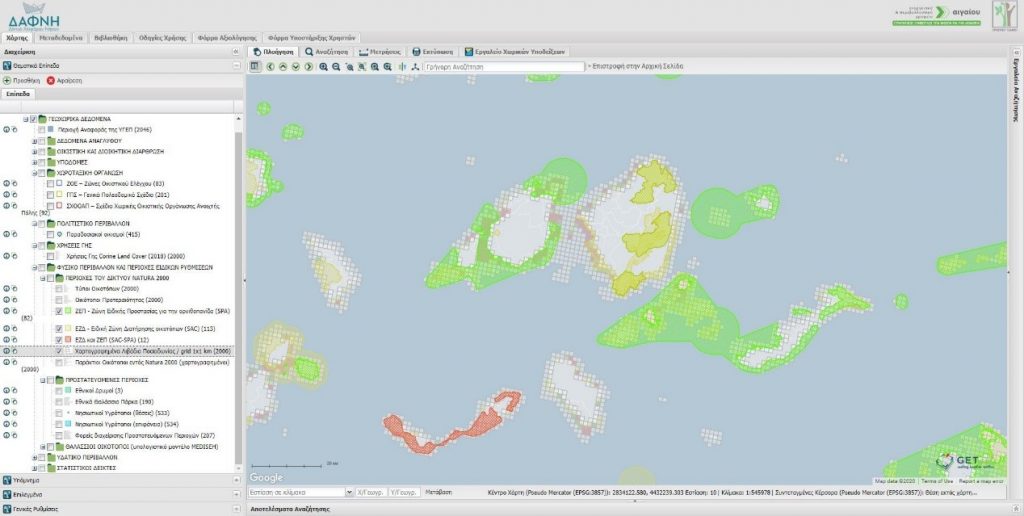
The SDI platform was designed in such a way as to be fully scalable in the future and able to encompass several other datasets that are currently unavailable.
By left-clicking on any map point, object recognition is performed. The system displays the object properties (attributes) just like in any GIS system.
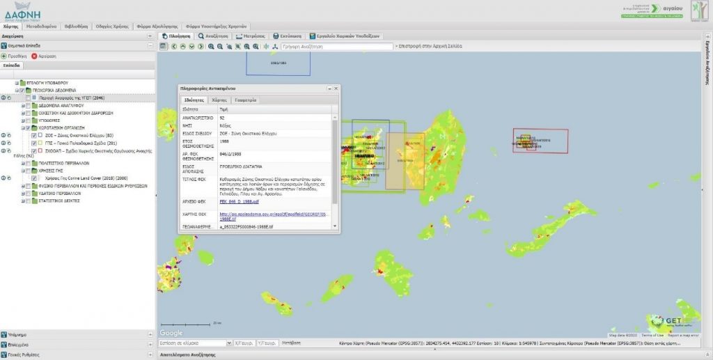
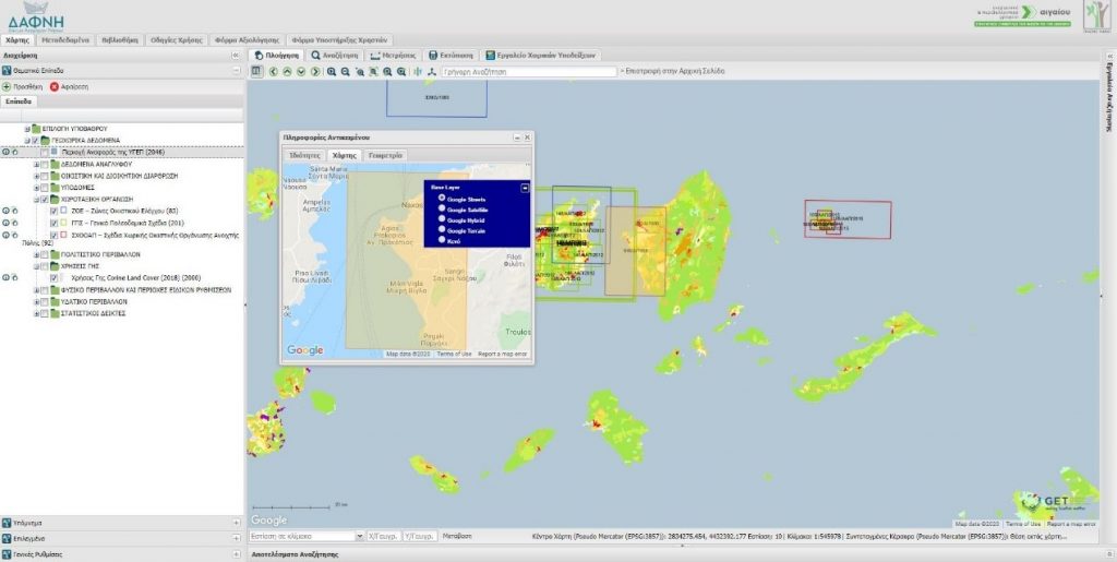
The “Spatial Suggestion Tool” is a powerful tool as it enables the users to :
- accurately identify discrepancies or deficiencies in the map at each thematic layer available to the SDI
- provide comments and observations on the qualitative and quantitative information accompanying each object
In this way, the accuracy and completeness of the provided data is checked and ensured, while the data is constantly updated.
Therefore, having all the above tools in hand, the users, either an island officials or individuals and professionals, are able to collect all the necessary spatial and descriptive information, analyze it and draw important conclusions to support optimally their work.
