Life ASTI Final Conference
The LIFE ASTI project and GET are pleased to invite you to the Final Conference, on May 19, 2022. The Final Conference of the LIFE ASTI project will be focused on the final results and achievements of the LIFE ASTI project and will be held as a hybrid event on 19 May...
GET BECOMES MEMBER OF THE DISASTER RESILIENCE INNOVATION CLUSTER DEFKALION
GET became a member of the Disaster Resilience Innovation Cluster - Defkalion (DRIC Defkalion). Having already in our portfolio targeted solutions related to the field of Climate Change, but also participation in a variety of research projects that address the topic...
Announcement regarding the test use of the TRIMBLE MX7 Mobile Mapping data recording system that we are carrying out.
GEOSPATIAL ENABLING TECHNOLOGIES LTD (hereinafter GET), (www.getmap.eu), announces that during the period from 01/04/2022 to 31/12/2022, we will carry out test work trials of the Mobile Mapping TRIMBLE MX7 data recording system. The test work trials will be done with...
RENEWAL OF THE CONTRACT WITH THE MUNICIPALITY OF THESSALONIKI FOR ACCESS TO COPERNICUS SATELLITE DATA, VIA STANDARDIZED WEB SERVICES
The Municipality of Thessaloniki renewed its contract with GET for accessing the Copernicus Satellite data, via standardized web services. The project provides almost real-time access to Copernicus system Sentinel 1,2, 3 & 5 satellite data via standard OGC (OGC...
RENEWAL OF THE CONTRACT WITH DAEM FOR IMPLEMENTING APPLICATION FOR THE MANAGEMENT OF TECHNICAL STUDIES
Η Ανώνυμη Αναπτυξιακή Εταιρεία Μηχανογράφησης και Επιχειρησιακών Μονάδων Ο.Τ.Α. του Δήμου Αθηναίων (ΔΑΕΜ) προχώρησε σε ανανέωση της σύμβασής της με τη GET για την εφαρμογή Μητρώου Τοπογραφικών Διαγραμμάτων (ΜΤΔ). Πρόκειται ουσιαστικά για την για την κάθετη εφαρμογή...
COMPLETION OF THE PROJECT “SUPPLY OF SPECIAL EQUIPMENT FOR CIVIL PROTECTION FOR OUTDOORS RISK MANAGEMENT FOR THE MUNICIPALITY OF HERAKLION”
GET in collaboration with JGC SA successfully implemented the project of the Municipality of Heraklion, which concerns the supply of special civil protection equipment for risk management. The mission of the platform developed is to help in crisis situations due to...
COMPLETION OF THE PROJECT “DEVELOPMENT OF OPEN ENVIRONMENTAL DATA PORTAL” IN SUPPORT OF THE OPERATION OF “PILOT MECHANISM FOR INFORMATION, PREVENTION, MANAGEMENT AND AWARENESS, FOR RISKS ARISING FROM CLIMATE CHANGE IN THE URBAN ENVIRONMENT OF PIRAEUS “
GET has successfully implemented the development of the "Open Environmental Data Portal" for the Municipality of Piraeus. Climate change is an indisputable global phenomenon. Large cities contribute significantly to climate change, as urban activities are major...
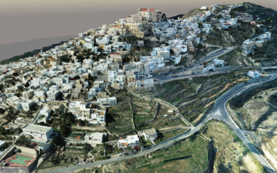
5D ARCH AID RESEARCH PROJECT – COMPLETION OF THE STATE-OF-THE-ART TOPOGRAPHIC 3D BACKGROUND FOR THE HISTORICAL SETTLEMENT OF ANO SYROS
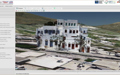
The research project “5D ARCHitectural AIr Documentation – 5D ARCH AID” funded in the framework of the HORIZON2020 European project UFO, is implemented by a collaborative group of four (4) partners: Asociatia Monumentum, JGC, HERITAGE MANAGEMENT e-SOCIETY (HERMeS) and...
COMPLETION OF THE PROJECT “ENVIRONMENTAL OBSERVATORY FOR THE MUNICIPALITY OF AGRINIO”
GET successfully completed the emblematic project of the Environmental Observatory of the Municipality of Agrinio. The project was included in the "Digital Strategy of the Municipality of Agrinio 2019-2024" and the main "Priorities of the National Digital Strategy in...
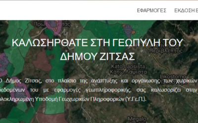
COMPLETION OF THE PROJECT “MAINTENANCE SERVICES OF SPATIAL DATA (GIS) FOR THE MUNICIPALITY OF ZITSA”
GET successfully completed one more project in the field of Local Government and more specifically for the Municipality of Zitsa. The Municipality of Zitsa has set as a priority and main axis of its planning, the digital transformation. In this context, it constantly...
AVAILABLE TO THE BROAD PUBLIC THE SPATIAL DATA INFRASTRUCTURE OF NAXOS MUNICIPALITY AND SMALL CYCLADES
The Municipality of Naxos and the Small Cyclades recently announced the acquisition of Geospatial Information Infrastructure, a project which was successfully implemented by GET. The Municipality of Naxos and the Small Cyclades has set as a priority and key axis of...
GET in 2021
In our annual infographic below we show selected highlights for 2021. Our 2021 total revenue has been increased by +9% recording high profitability, while a significant amount of back log orders exists. We have delivered 46 projects (+27% more than 2020) with the same...
30 Municipalities implemented projects of SMART & SUSTAINABLE CITY
In recent years at GET we have developed many applications for various local authorities, providing high quality services for the creation and technical support of applications that meet the daily needs and technical requirements of the Municipalities. All projects...
NEW PROJECTS TO UPGRADE AND EXTEND THE SOLUTIONS PROVIDED BY GET FOR RAE, MUNICIPALITY OF AGIOS NIKOLAOS AND MUNICIPALITY OF CHALANDRI
GET has strategically chosen to keep its existing clientele active, which presupposes that we must prove our consistency to the existing customer - partner in terms of a range of commitments and characteristics such as: Adherence to the schedule, implementation of...
NEW PROJECT FOR THE UPGRADE AND EXTENSION OF THE NATIONAL AIR POLLUTION MONITORING NETWORK IN THESSALONIKI URBAN COMPLEX
GET participates, as a subcontractor of the company "SCIENTIFIC ENTERPRISES LTD", in the implementation of the project "Supply of Equipment for the Upgrading and Expansion of the National Air Pollution Monitoring Network (E.D.P.A.R.) in Thessaloniki Urban Complex". In...
RENEWAL OF THE COOPERATION IN THE MUNICIPALITIES OF THESSALONIKI & CORFU
GET successfully continues the development of projects for Local Government authorities, with the object of implementing Spatial Data Infrastructures - Spatial Data Infrastructures, in accordance with the INSPIRE Directive and the supply of "vertical" applications....
ENVIRONMENTAL HISTORY OF BYZANTIUM AND THE OTTOMAN EMPIRE – DATABASES AND MAPPING PRODUCTS AS SCIENTIFIC TOOLS
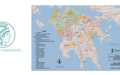
GET has a long-standing partnership with Max Planck's Palaeo-Science and History team for the Advancement of Science (Max-Planck-Gesellschaft zur Förderung der Wissenschaften). Results of the above collaboration were presented in the context of the lecture series...
COMPLETION OF PROJECT “EXPANSION AND UPGRADE OF THE GEOGRAPHIC INFORMATION SYSTEM OF AGRINIO MUNICIPALITY”
GET successfully undertook and implemented the project "Expansion and Upgrade of GIS of Agrinio Municipality". The project is part of the actions of Development and implementation of "smart city” solutions in the Urban areas, of Sustainable Urban Development in the...
COMPLETION OF R&D PROJECT MOUSEION TOPOS
The project “MuseionTopos”, were GET participated, project code: Τ1ΕΔΚ-01571 under the framework “RESEARCH – CREATE – INNOVATE” of the Operational Programme “Competitiveness Entrepreneurship Innovation” (EPAnEK 2014-2020), Partnership Agreement 2014-2020, was...
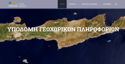
NEW PROJECT FOR THE MAINTENANCE AND EXPANSION OF THE SPATIAL DATA INFRASTRUCTURE FOR THE REGION OF CRETE
GET successfully continues the development of projects in the field of Regional Government, implementing Spatial Data Infrastructures (SDI), in accordance with the INSPIRE Directive. The Region of Crete, having been fully satisfied after the implementation of the...


