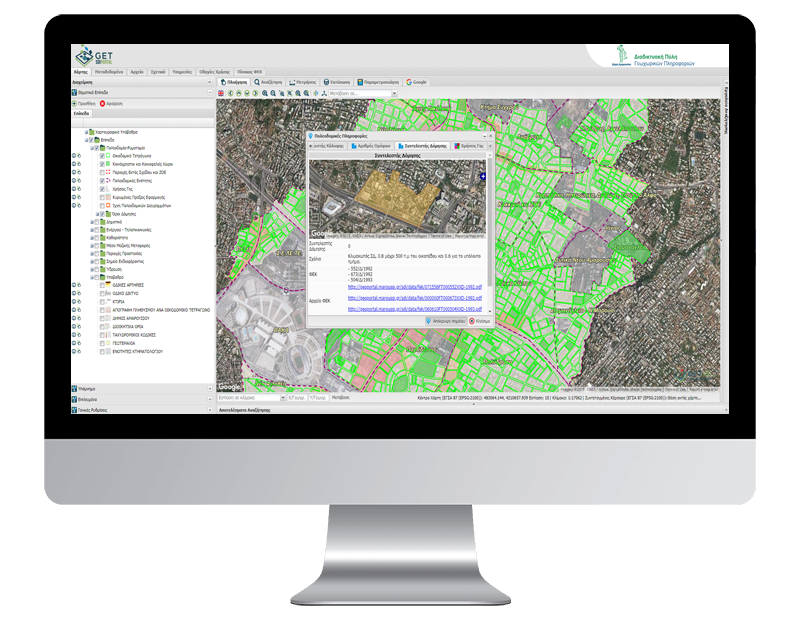
Spatial Data Infrastructure for Urban Planning for the Municipality of Maroussi

PROFILE
Name: Municipality of Maroussi
Website: https://www.maroussi.gr/
The Municipality of Maroussi is one the biggest Municipalities in Attica and its purpose is to improve provided services to the citizens and to enhance daily life of its residents. Maroussi Municipality invests in social and environmental activities as well as in updating of public use infrastructures considering the demands and needs of citizens
An innovative initiative was taken by the Municipality of Maroussi, regarding the urban planning data of the city, moving to the new digital age.
Utilizing technology, modern interoperability tools and the vast knowledge of human resources, the municipality digitized the entire city plan, giving free access to every interested party, so that through a computer, wherever one may be, can receive information about a significant number of data, regarding the urban planning organization and planning of the Municipality, per planning unit, in terms of building blocks, building conditions, land use, fields, roads, etc.
As a result, valuable time and money are saved, as the time occupied by the Municipality’s human resources and transportation of the interested parties are reduced.
The most important thing though is that there is added value from the collateral utilization of the data and information, directly and efficiently by the services of the Municipality, such as Cleanliness, Environment, etc. for the benefit of the citizen.
In addition, IT, which is an important tool for extroversion, gives tangible and measurable results. Statistically, it is estimated that during the one and a half years of operation of the application, the flow of interested engineers and citizens will have decreased by 30-40%, compared to the current number.
Moreover, this way, the validity of the information is ensured, which will now be common and immediate for everyone.
The Municipality of Maroussi ensured the maximum result in the most economical way, providing free access to everyone and choosing tools with open software licenses, which means huge cost savings in acquiring and developing the application, while the possibility of sharing is also provided

TECHNOLOGY
- PostgreSQL
- PostGIS
- Quantum GIS (QGIS)
- Geoserver
- GeoWebCache
- Geonetwork Opensource
- GET SDI Portal


