GET in cooperation with «NAMA Consulting Engineers and Planners S.A.» has successfully completed the development of innovative applications that support the operation and the decision making of the Municipal Enterprise of Water and Sewage of Thermaikos (DEYATH). The applications were developed as part of the WATER RESCUE project of the INTERREG Greece – Bulgaria program aiming at improving the efficiency of water resources and reducing non-revenue water (NRW).
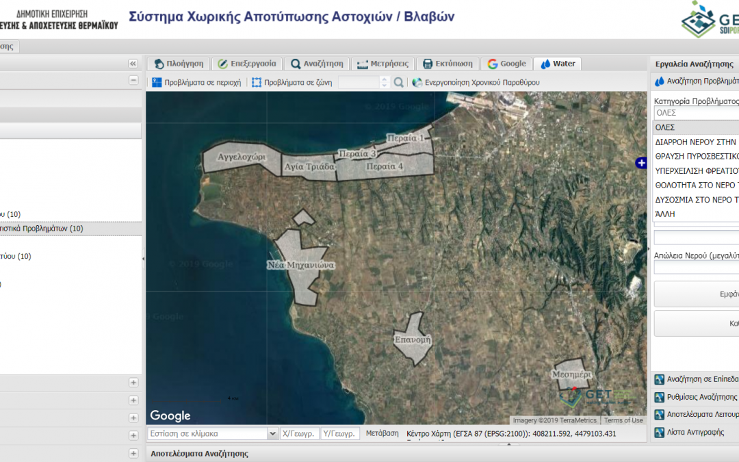
The first application that was provided enables the Agency to monitor the spatial and temporal evolution of faults. Each damage and its related information (cost, water loss, materials used, etc.) are plotted on a map with search and query capabilities as well as spatial analysis tools. In this way, the Agency can identify areas where there is significant water loss and high cost of rehabilitation and therefore design projects and interventions to improve network operation and reduce operating costs and NRW.
The application provides advanced tools for spatial analysis. In addition, it generated thematic maps of cost and water loss that support decision making.
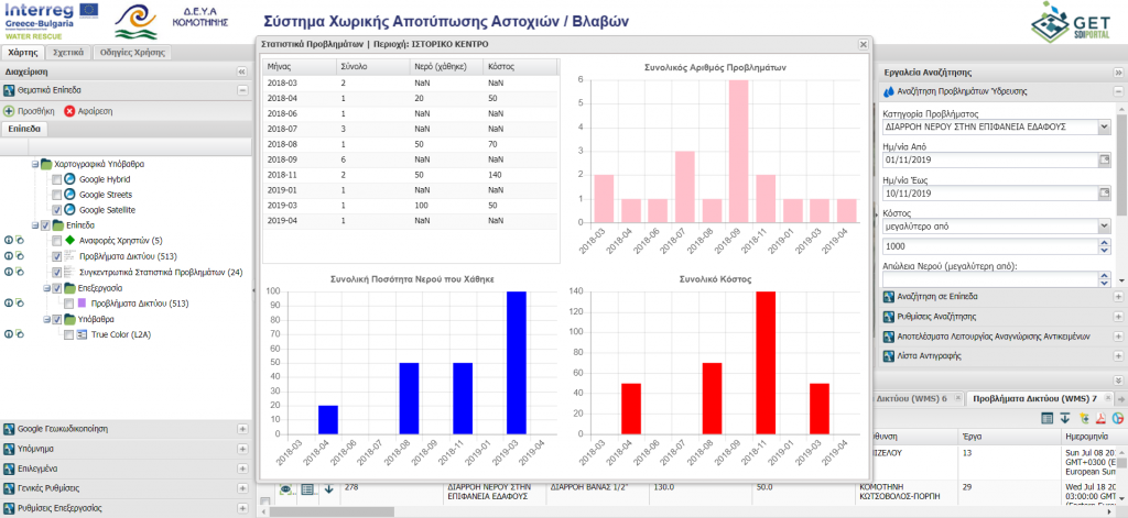
Aggregated statistics on faults and water loss
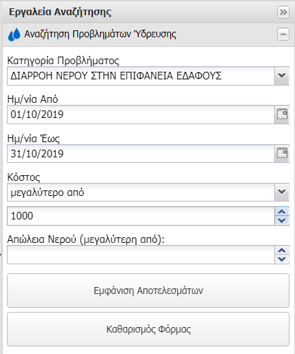
Query tools on faults and water loss
The second application enables the company to manage the geospatial data related to the water distribution networks and the associated infrastructure. The application has been developed as an addon in QGIS software, increasing the functionality it provides.
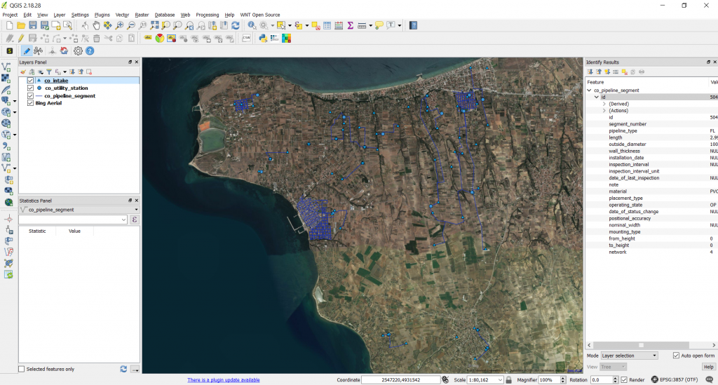
The user interface in QGIS
It provides the following functionalities:
- Supports the management of spatial data entities. Depending on their type, the users can enter data through custom user-friendly forms
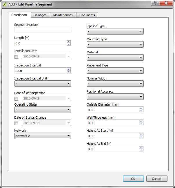
Pipeline segment management form
- In case where there are relations among feature classes the application enables the data entry to be performed with map interaction or from the form of the master entity
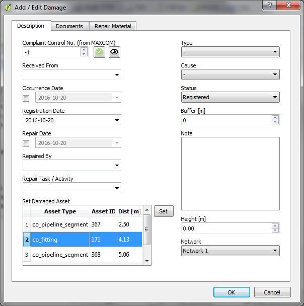
Topological rules / relationships in data management
- Ability to assign link documents or photographs to features as hyperlinks
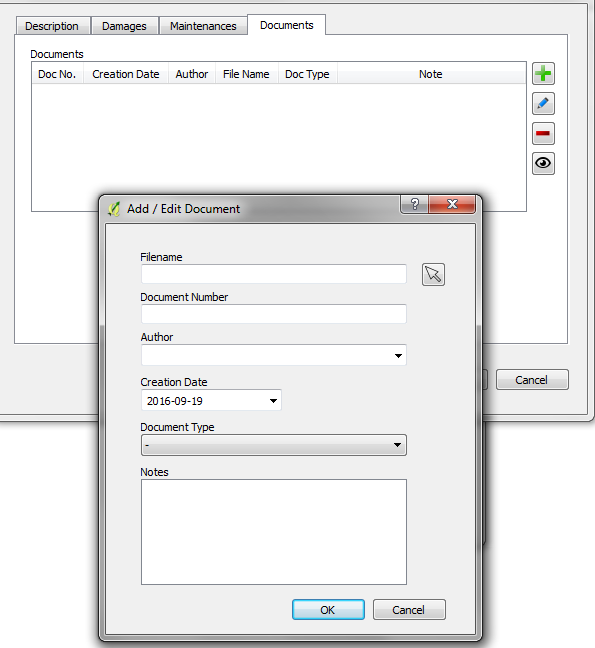
Attachment editor form
- Topology management with the ability to apply various different topological rules to ensure data quality and integrity
- Ability to perform combined spatial / attribute queries
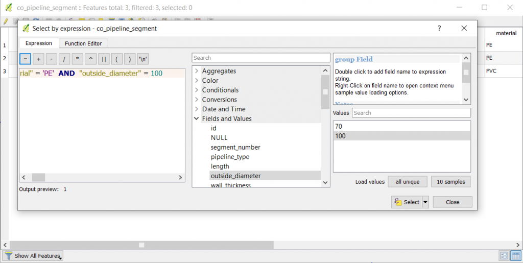
Query expression editor
- Custom print templates that can be designed interactively to include multiple map elements: Map. Legend, Title, Text, Scale etc.
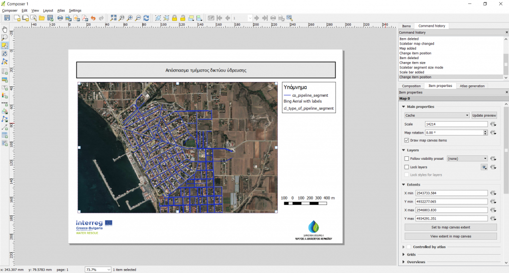
The user interface for the design of print templates
- Calculation of statistical information related with materials used, construction date, pipelines length etc.

