Development of GeoICT tools for the Municipal Enterprise of Water and Sewage of Thermaikos

PROFILE
Name: Municipal Enterprise of Water and Sewage of Thermaikos
The Municipal Enterprise of Water and Sewerage of Thermaikos is a legal entity of private law of public interest. It is governed for the administration, organization, execution, operation and maintenance of its projects as well as its funding by the provisions of Law N.1069/80.
The company was founded in 2011 after the merging of the municipal enterprizes of Thermaikos, Michaniona and Epanomi, based on the provisions of Law 1069/80. It operates to meet the water supply and sanitation needs of the citizens of the Municipality, to improve the existing water supply network, to complete, construct and operate the sewerage system, and to provide effective and integrated cleaning services to the Municipality and the wider area.
Website: http://www.thermaikos.gr/δημος/dimotikes-epixeiriseis-npdd/dimotiki-etaireia-ydreysis-apoxeteysis
The INTERREG Greece-Bulgaria Cross-Border Cooperation project Water Rescue aims at the sustainable management of drinking water distribution thus ensuring the efficiency of water resources. Sustainable management of cross-border water resources will be achieved by improving the efficiency of water resources (reduction of non-revenue water – NRW) and water quality (across the supply chain from source and back to environment) through development and adaptation of common methodological framework and tools. The Municipal Enterprise of Water and Sewage of Thermaikos is among the partners of the project.
Within the framework of this project, GET has undertaken the implementation of specialized GeoICT tools that support the operation of the Enterprise and the achievement of the objectives of the project.
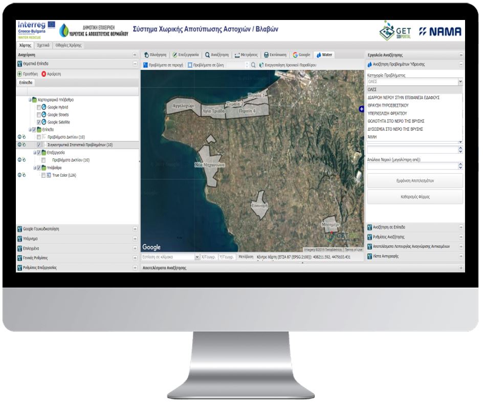
The first application that was provided enables the Agency to monitor the spatial and temporal evolution of faults. Each damage and its related information (cost, water loss, materials used, etc.) are plotted on a map with search and query capabilities as well as spatial analysis tools. In this way, the Agency can identify areas where there is significant water loss and high cost of rehabilitation and therefore design projects and interventions to improve network operation and reduce operating costs and NRW.
The second application enables the Agency to communicate with the citizens. Specifically, it provides information for scheduled water outages in the area (via the website and by email) and in addition it allows citizens to report a problem / damage. The problem is resolved by the department in accordance with their internal procedures, while keeping a complete track record of activities, cost and materials. The application reduces the response time from the Agency, which results in the reduction of water losses and consequently reduction of NRW.
The second application enables the company to manage the geospatial data related to water distribution networks and the associated infrastructures. The application has been developed in QGIS software, enhancing the functionality it provides. Among others it enables the maintenance of a topologically correct water supply network, the management of the network information (through custom forms that implement the database schema), the ability to search by spatial and descriptive criteria, thematic maps, printing templates etc.

TECHNOLOGY
- PostgreSQL
- Geoserver
- GET SDI PORTAL
- QGIS
USEFULL LINKS
- The applications are available for the internal users of the company


