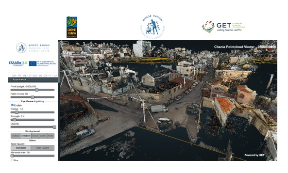
The union of GET and ASTROLAVOS TECHNIKI successfully completed the creation of the new 3D Models of the road network and other infrastructures of the Municipality of Chania, as well as their integration in the municipality’s existing Spatial Data Infrastructure (SDI).
This project was actually the B SECTION “ Enrichment of geospatial data infrastructure (3D models of road network and other infrastructure)” of the project “Configuration of a Control Center and reinforcement of critical infrastructures to address risks in the Municipality of Chania” funded by the program ANTONIS TRITSIS call “AT08 Smart Cities”.
With the delivery of the project, 400 km of urban – suburban – interurban roads and 10 km of pedestrian streets of three-dimensional background of high precision, are now available to the services of the Municipality, professionals and citizens through the existing SDI of the Municipality of Chania. More specifically, more than 207,000 panoramic images, over 6000 files with point clouds and over 17,500 vector data records, were delivered.
The implementation was based on the utilization of open-source technologies / software, which ensure the viability of applications in the long run due to low maintenance costs, as well as the full utilization of existing software and infrastructure of the Municipality of Chania.


